Maps of Time and Place at the McCaw Foundation Library
A map is a visual depiction of a particular place, and it is a reflection of the perspectives of the time in which it was made. We can better understand the way people in a particular era saw the world – and their place in it – by looking at the maps they used.
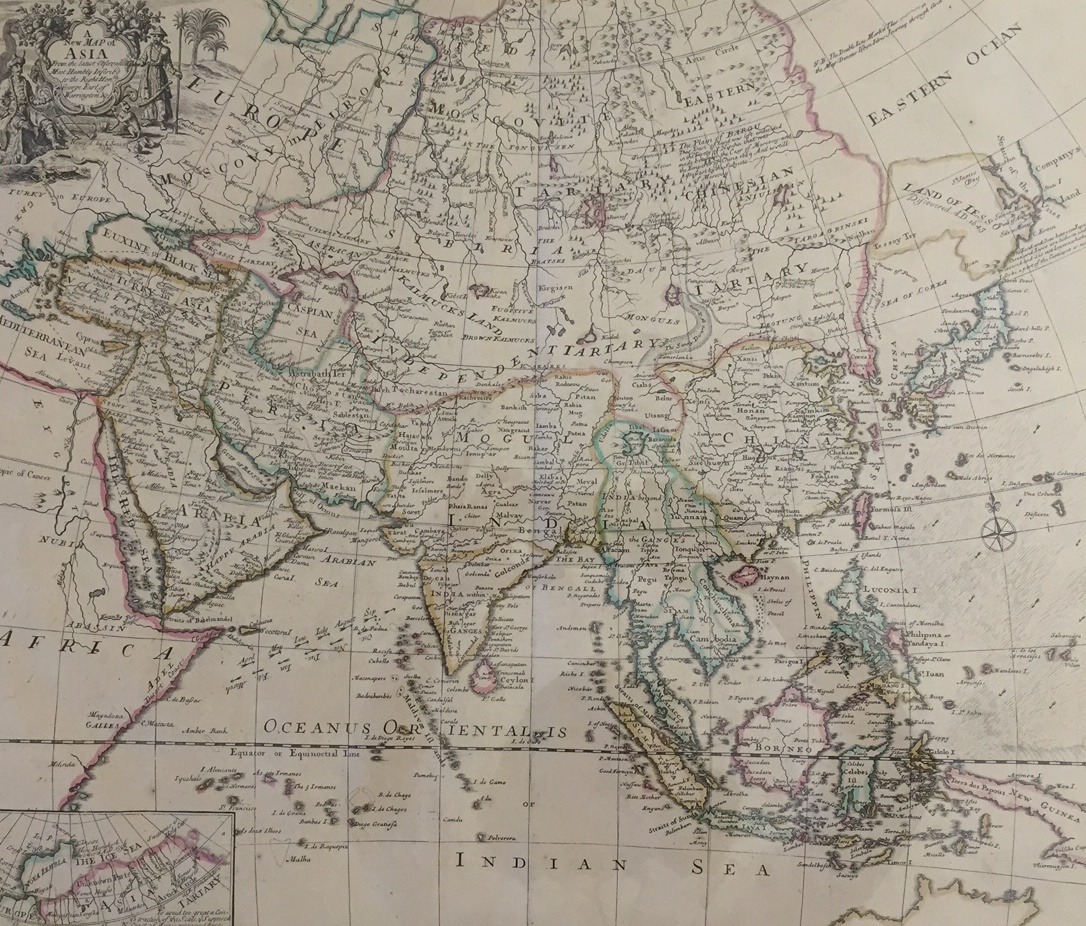
A New Map of Asia from the Latest Observations: Most Humbly Inscribed to the Right Honbe. George Earl of Warrington, 1721. London: D. Browne. SPCOL G 7400 I710 S4. Donated by Frank Bayley, acquired from the collection of former SAM Curator of Japanese Art, William Jay Rathbun.
John Senex’s (English, 1678-1740) New Map of Asia, which dates from 1721, is a representation of the technical information available at the time. It also provides insight into the way European explorers viewed the countries in Asia and their relationships to each other. Senex was a geographer to Queen Anne (1665-1714), and one of 18th century England’s best known map makers. His map of Asia contains a lot of information.
Detail from A New Map of Asia from the Latest Observations: Most Humbly Inscribed to the Right Honbe. George Earl of Warrington, 1721. London: D. Browne. SPCOL G 7400 I710 S4. Donated by Frank Bayley, acquired from the collection of former SAM Curator of Japanese Art, William Jay Rathbun.
It spans a vast geographical area from the tip of North Africa and part of the Mediterranean in the west to Indonesia and Japan in the east; from what is now Mongolia in the north to New Holland (now called Australia) in the south. It notes the currents along the east coast of Southeast Asia, the Philippines, and the Indian Ocean. Areas that were most thoroughly explored by the 18th-century English are the ones that include the most detail; those that were not as well-known are more generally depicted, such as the “Land of Less” and “Company’s Land,” which are shown as large, indistinct land masses, as is the “Eastern Ocean” to the north of them. In the upper left corner, a cartouche includes two people in stylized Asian dress, surrounded by representations of some typical animals and plants.
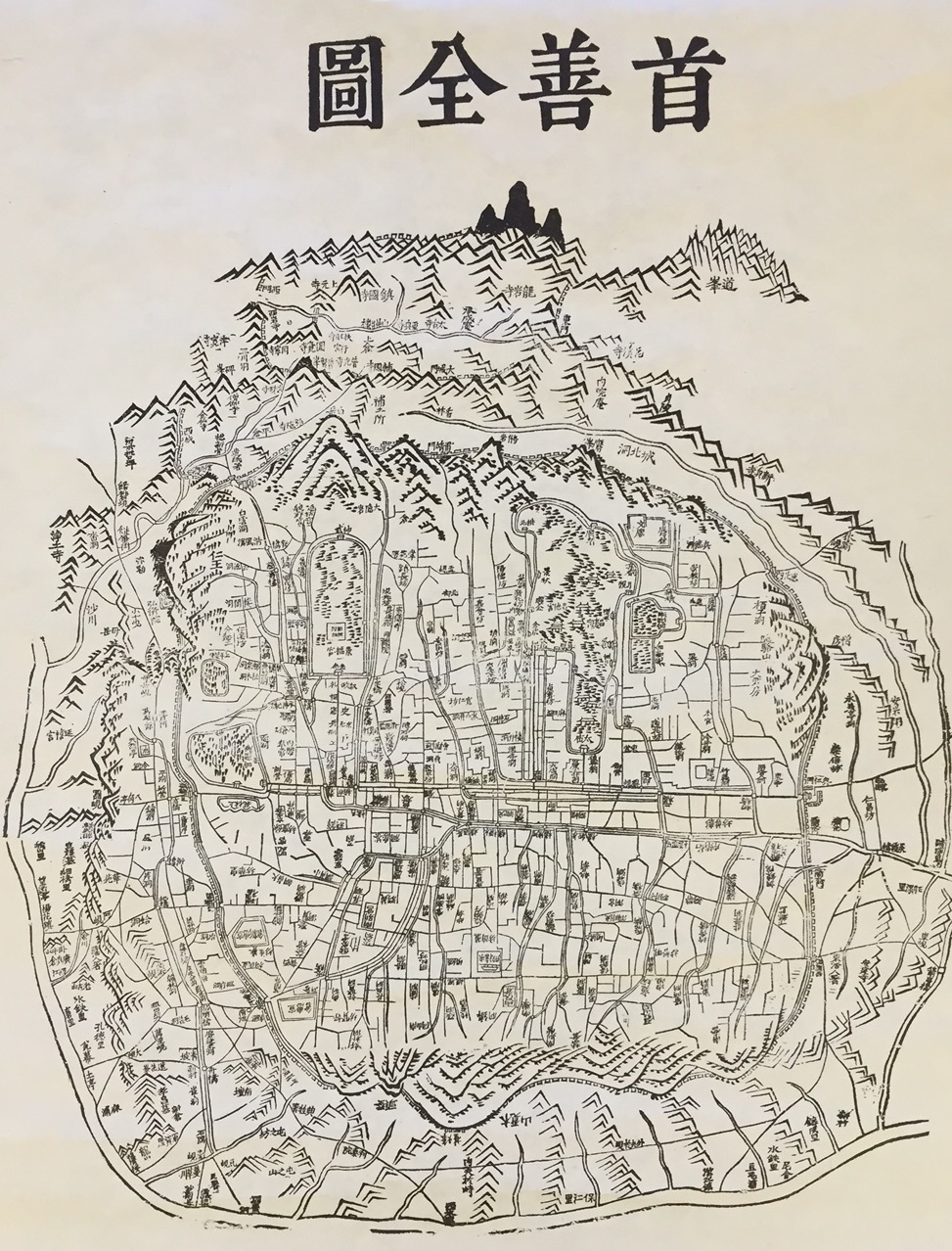
Suseon Jeondo (Whole Map of Seoul), between 1861 and 1887. Seoul, Korea: publisher unknown. SPCOL G 7904 S4. Donated by Kimerly Rorschach.
Similarly, cartographer Jeongho Kim’s (Korean, active 1834-1864) Suseon Jeondo (Map of Seoul) shows us what was important in Korea in 1845, during the Joseon Dynasty. This is a map drawn by someone intimately familiar with the area and the people and practices that characterized the time in which it was made and used. The use of Chinese characters is typical of formal documentation of that time.
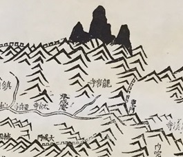
Detail from Suseon Jeondo (Whole Map of Seoul), between 1861 and 1887. Seoul, Korea: publisher unknown. SPCOL G 7904 S4. Donated by Kimerly Rorschach.
The wood-block print map of Hanyang (Seoul) thoroughly surveys the entire city: major roads, facilities, and villages are realistically represented more or less to scale. These precisely depicted everyday elements of the city are ringed by symbolic portrayals of larger-than-life mountains, creating a significant contrast. These mountains, traditionally a symbolic connection between the sky and the authority of the king, are intentionally drawn larger than to scale to emphasize their connection to the heavens.
We invite you to see these maps in person at the McCaw Foundation Library at the Asian Art Museum. The library’s public hours for the summer are: Thursdays and Fridays, 2 PM – 5 PM; Saturdays 10 AM – 2 PM. (Please note that the library is closed July 2-5, 2015.)
– Kate Nack, Library Volunteer, McCaw Foundation Library for Asian Art
Bibliography:
Kim, Jeongho. A map of Seoul in the period of Joseon Dynasty. Seoul: J. Kim, ca. 1845.
Senex, John. A new map of Asia: from the latest observations. London: D. Browne, 1721.